Acquire Elevation Imagery

This exercise teaches you to acquire free elevation data from the USGS to analyze with the Octopus app.

Acquire Elevation Data

  1. Start the Shell app. (Start » Programs » Scenomics » Shell) or (Windows® key and then type 'Shell' to find the app icon.)

    The application displays a splash screen and then the application desktop appears.

  2. Start a web browser (leave the Shell app running)

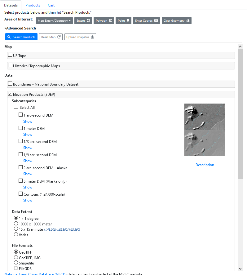
    We need some elevation data. There are many sources and formats, but for now we'll focus on GEOTIFF elevation data that we can acquire from the United States National Map.

  3. Load the following URL: https://apps.nationalmap.gov/downloader/#/

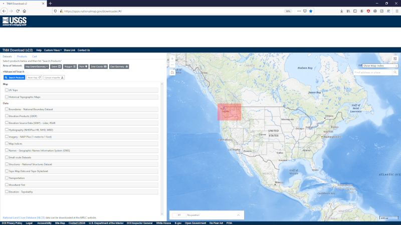
    NOTE: In the image below, we've placed a red box around the area of interest: Washington State. You won't see this red box on your map, but this will help you know where to zoom in the next step.

    This is a picture of the national map home screen.
  4. Zoom in to Washington State, which is in the upper left corner of the continental United States.

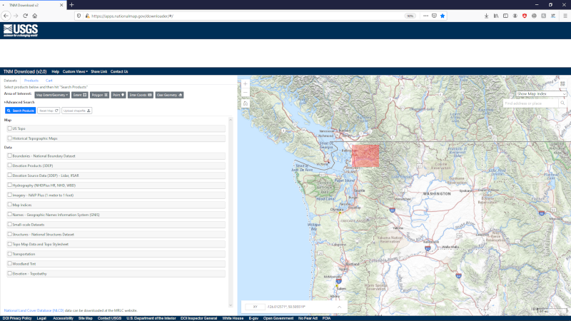
    NOTE: In the image below, we've placed a red box around the area of interest: Mt. Baker National Forest, near Bellingham, Washington State. You won't see this red box on your map, but this will help you know where to zoom in the next step.

    This is a picture of the national map zoomed in on Washington State.
  5. Zoom in to the Mt. Baker area, which is in the northwest corner of Washington State, east of Bellingham, WA. This is a picture of the national map zoomed in on the Mt. Baker region of Washington State.
  6. Examine the product search and download options on the left side of the browser window. This is a picture of the national map elevation products and download options.
  7. Check the Elevation Products (3DEP) option.

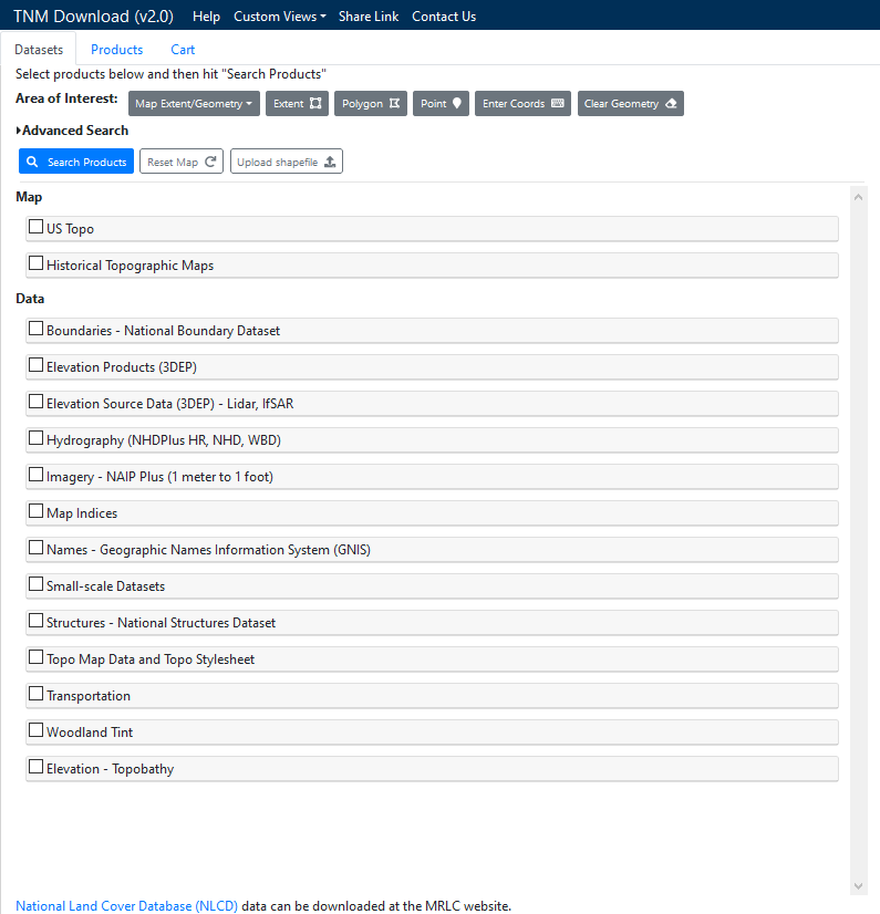
    This displays a list of elevation products.

    This is a picture of the national map elevation products.
  8. Left click the 1/3 arc-second DEM option.
  9. Left click the blue Search Products button near the top-left of the products and download options area.

    The National Map Viewer searches for available elevation imagery and displays the results. NOTE: We have highlighted the elevation data of interest with a red box. You won't see this red box in your search results. The desired data file refers to USGS 13 arc-second n49w122 1 x 1 degree.

    You may need to scroll to find the right file to download.

    This is a picture of the national map elevation search result.
  10. Examine the search results and left click the option Download TIF option in the right column of the elevation data preview window.

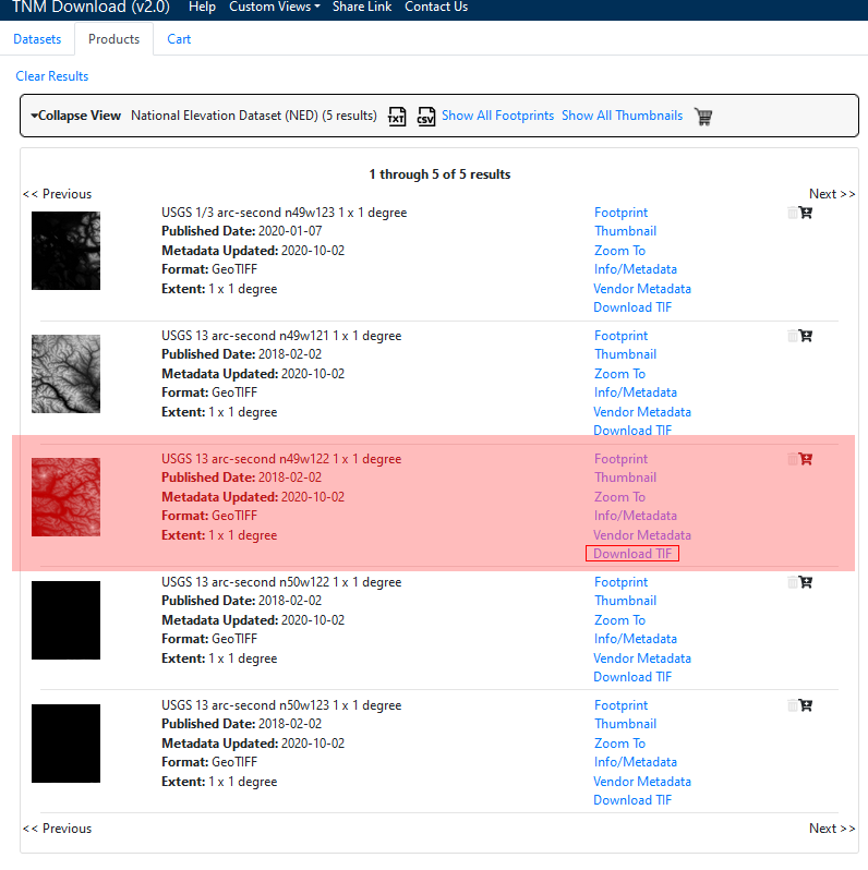
    NOTE: This file is about 500MB in size.

    Your web browser presents a dialog that allows you to download the elevation data to your machine. The file will be saved to your downloads folder as USGS_13_n49w122.tif.

    Proceed to the next step when the download is complete.

  11. Return to the running copy of the Shell application.
  12. Select File » Open Application Directory... from the main menu.

    The software displays a list of directories to open.

  13. Select the option that ends with \Library\Textures\Elevation.

    The software opens a folder to this directory.

  14. Copy the GEOTIFF file USGS_13_n49w122.tif from your downloads folder into the elevation data directory we just opened.
  15. Close the folder containing the elevation data.
  16. Close your web browser if desired.
  17. Return to the running Shell application and select File » Exit from the main menu.